
I enjoy making hand-illustrated maps to celebrate the ecology and landmarks of the different natural places where I visit and live. These projects are fun for me because they encourage me to explore the ins and outs of each region and seek out locals, park rangers, and scientists to help inform my map.
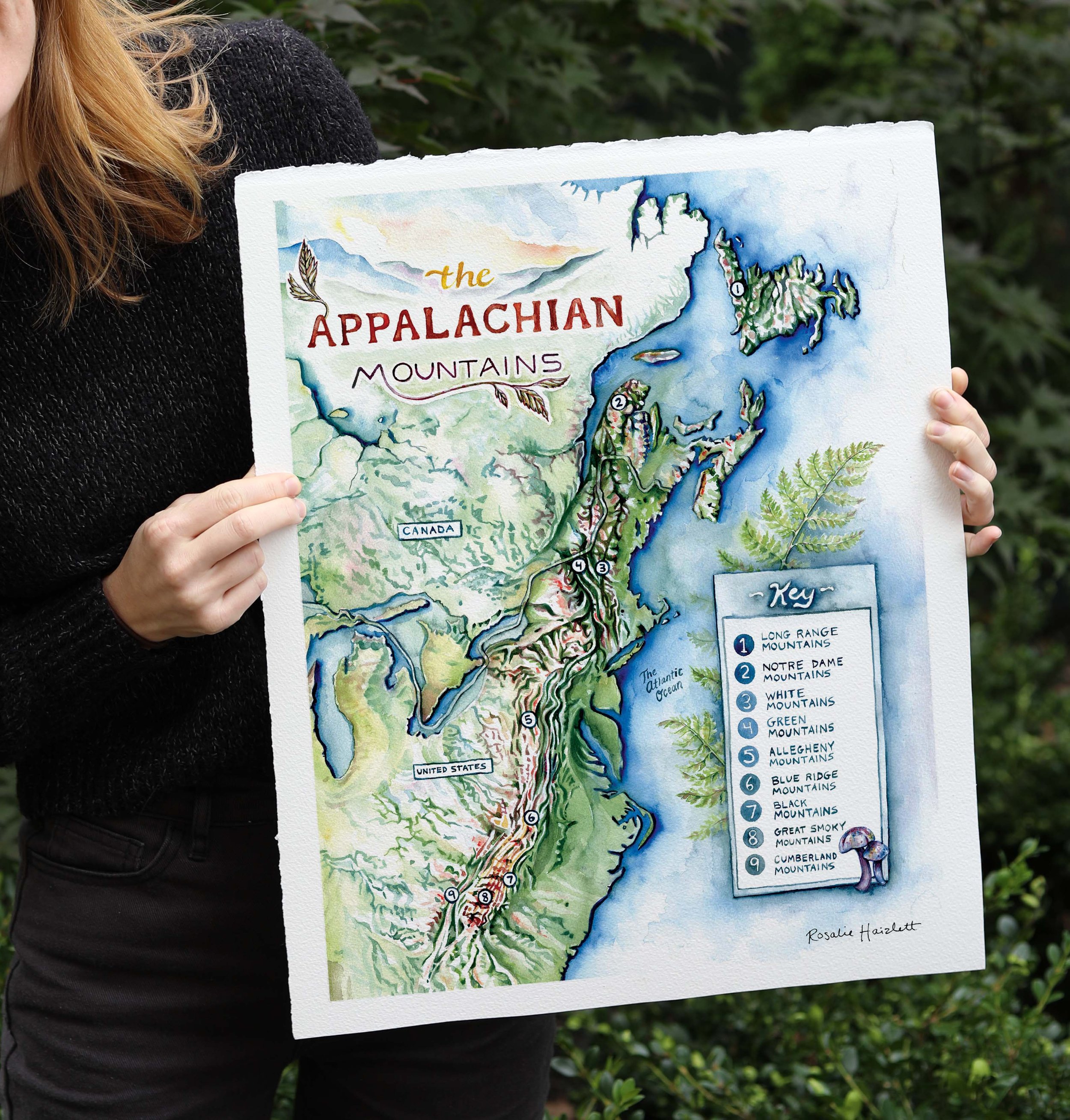
Map of the sub-ranges of the Appalachian Mountains. Created using only watercolor.

Coopers Rock State Forest Illustrated Map

Map of Monongahela National Forest for USDA Forest Service

Map of Dolly Sods Wilderness, West Virginia

Map of Blackwater Falls State Park, West Virginia

Illustrated map of the watersheds of Western Pennsylvania for Dancing Gnome Brewery

Illustrated hiking map of Canaan Valley, West Virginia.
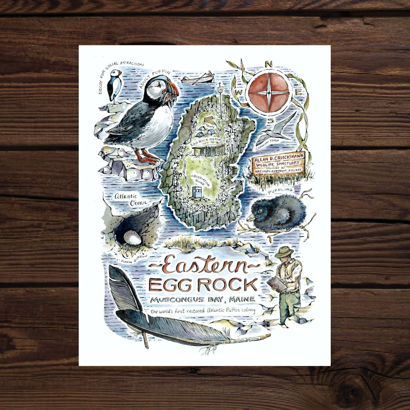
Created after a visit to Eastern Egg Rock during my artist residency with the National Audubon Society in 2019

Commissioned map of the town’s nature trail for sesquicentennial of the historic Swiss community of Helvetia, West Virginia.

Created during my artist residency on Hog Island with the National Audubon Society in 2019